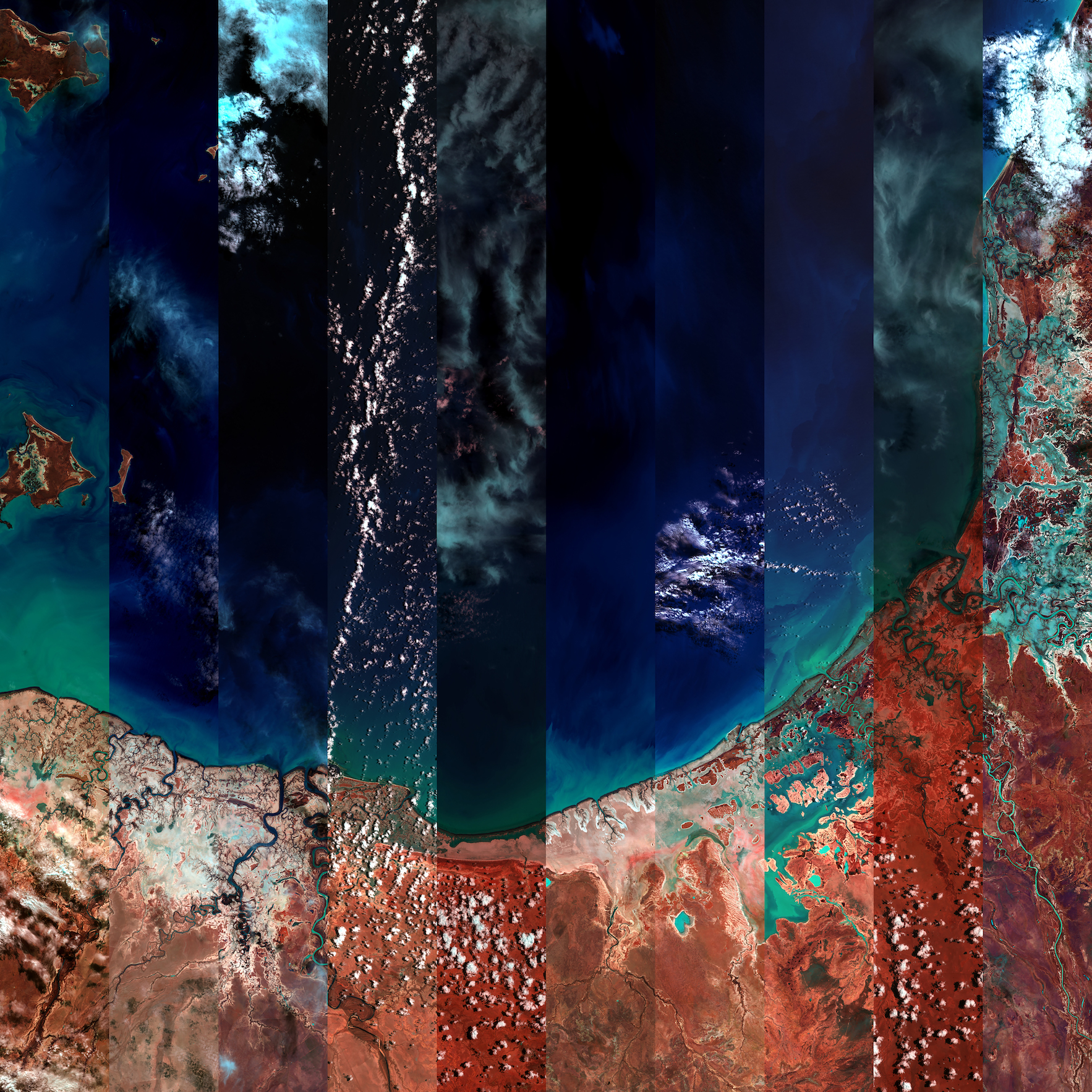
12 Months Over the Gulf of Carpentaria
For the past 40 years, NASA Landsat satellites have orbited the Earth. Performing what is known as ‘remote sensing’, they use sensors that record both visible and infrared light, to produce data used by geoscientists and the private sector to track environmental change over time.
12 Months Over the Gulf of Carpentaria is precisely that: a time-lapse mosaic of satellite images over the Gulf, showing the changing atmospheric conditions over a period of a year.
Produced through a partnership with Geoscience Australia and the Digital Earth Australia platform, this image is part of an ongoing exploration of how creative uses of satellite data can both reinforce the environmental monitoring function of the Landsat program and introduce new conceptual and artistic dimensions.
This project seeks to release satellite imaging from a directly instrumental purpose, fostering a way of knowing that acknowledges our connectivity to and feeling for the world.